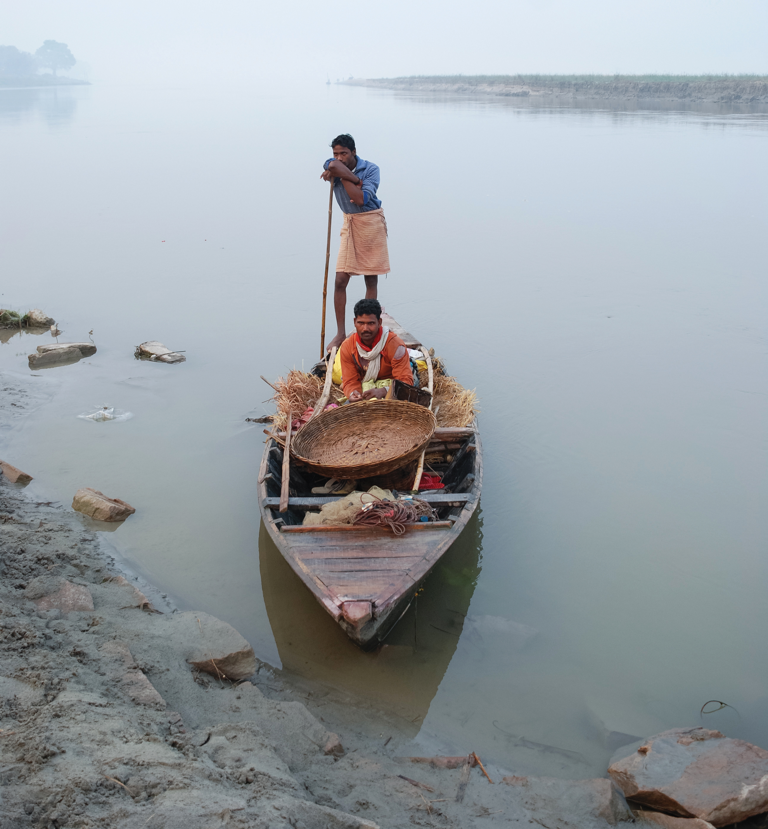
Two fishermen return home empty handed. Recent weather conditions and anthropogenic interferences have contributed to a significant decrease in fish catch in the Champaran, Bihar, stretch of Burhi Gandak.
Abstract: With advancements in the science of simulation modelling, climate models have improved their projection capabilities. This can have an important bearing on the future hydrology of flowing surface waters in the current context of climate change.
The authors are professor and research scholar, respectively, Institute of Environment & Sustainable Development, Banaras Hindu University, Varanasi. rkmall@bhu.ac.in
India is set to embark on a new chapter in its Polar exploration journey with the construction of Maitri II. The Indian government plans to establish a new research station near the existing Maitri ba...
The Deep Ocean Mission (DOM), approved by the Government of India in 2021 under the Ministry of Earth Sciences (MoES), represents a strategic step in realizing Sustainable Development Goal 14 (SDG 14:...
China recently announced restrictions on the export of seven rare earth elements (REEs), soon after US President Donald Trump decided to impose tariffs. As the world's dominant supplier—responsible fo...
The International Seabed Authority (ISA) marked a watershed moment on September 15, 2025, signing a 15-year contract with the Indian government, revolutionising deep-sea exploration. India has been gr...
It depicts the rate of flow (discharge) versus time elapsed at a specific point in a river, or other channel. These graphs are generally employed to understand the influence of climate such as seasonal rainfall, flood, drought and climate change on groundwater levels. In addition, hydrographs are also utilised to understand the response of aquifers to pumping and irrigation.
These are wells dug into aquifers under positive pressure. The water in artesian wells rises to a point where hydrostatic equilibrium has been reached naturally, without any artificial aid.
Bed flow is the sustained flow in a stream that comes from groundwater discharge or seepage.
Hydraulic conductivity refers to the permeability of water through a medium. It describes the ease with which water flows through the pores or fractures of an aquifer.
Recharge is the addition of water to an aquifer to replenish it. It may occur naturally through rain, runoff or through artificial measures like spreading basins and recharge wells/irrigation.
These processes are aimed to mitigate the effects of global warming. It involves a multitude of global climate modification programmes that function to tackle climate change by removing CO2 from the air.
Also called paleo-water, the term refers to ancient freshwater reservoirs created millions of years ago and trapped underground in deep aquifers.
Runoff is the water that flows over the surface of earth. The flowing water mostly is a result of storms, glacial melt, floods or other sources. Runoffs are crucial for aquifer recharge.
The term refers to the comparatively dry soil or rock located between the ground surface and the
top of the water table. The pores of the soil/rock of this zone contain both water and air.
These are sedimentary beds through which zero flow occurs because of lack of porosity. Aquicludes generally underlie or overlie an aquifer. In case of the latter, the pressure could metamorphose it into a confined aquifer.