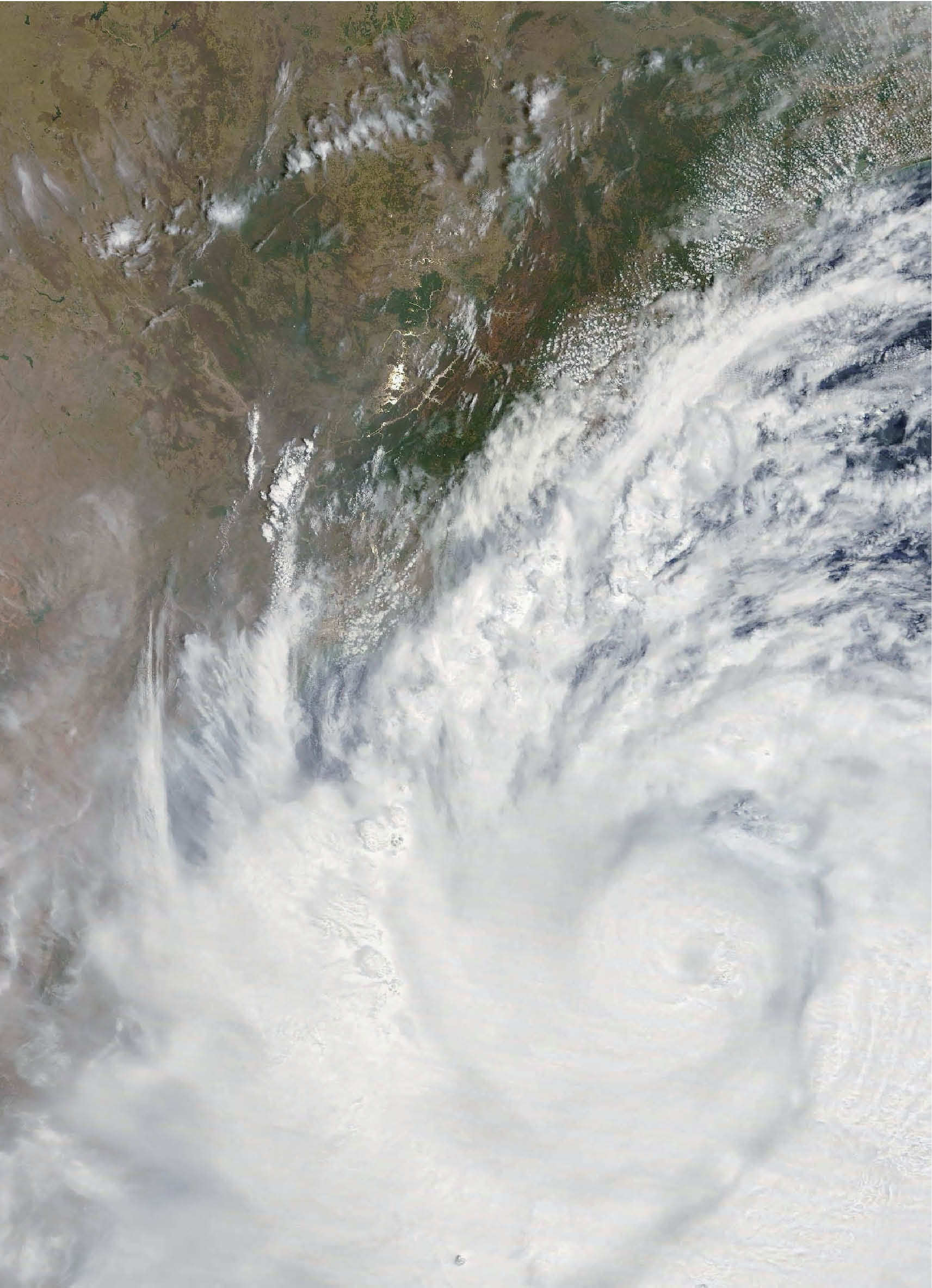
ESSO-IMD made the first operational forecast using the HWRF-HYCOM coupled system together with other models during April 2019 for tropical cyclone Fani, which made landfall in Odisha on May 3, 2019.
Abstract: Tropical storm forecast models conventionally use static sea surface temperature (SST), assuming its temporal changes are not significant in forecast. However, oceanic processes such as upwelling, currents and eddies, significantly modulate SST even at short time scales. Such changes have the potential to influence the planetary boundary layer. Eminent climate scientists, Morris A Bender and Issac Ginis have shown that inclusion of initial conditions with oceanic mesoscale features can improve hurricane/cyclone intensity forecasts. Scientific evidence thus supports better forecasts with coupled forecast systems and several forecast centres across the globe depend on such systems. In line with the international efforts, Ministry of Earth Sciences (MoES) and two of its institutes, ESSO-INCOIS and ESSO-IMD, established a state-of-the-art coupled forecasting system for cyclones arising in the Indian Ocean in collaboration with National Oceanic and Atmospheric Administration (NOAA) of USA. In the present article, we explore the relevance of the system and its performance in achieving this goal.
The authors are Head, Ocean-Atmosphere Coupled System Group (CSG), ESSO-INCOIS; Scientists, India Meteorological Department (IMD), Senior Scientists, National Oceanic and Atmospheric Administration, Former Director General, IMD, Director General, IMD; Director ESSO-INCOIS and Secretary, Ministry of Earth Sciences. sjo@incois.gov.in. The article should be cited as Joseph S., A. Srivastava, A.K. Das, A. Sharma, A. Mehra et al., 2020. Forecasting Tropical Cyclones in the Indian Ocean, Geography and You, 20(6-7): 48-53.
What if India's pathway to net zero does not end at factories—but begins where terrestrial meets the coastal? As carbon emissions rise and climate risks intensify, the search for solutions has largely...
India is set to embark on a new chapter in its Polar exploration journey with the construction of Maitri II. The Indian government plans to establish a new research station near the existing Maitri ba...
The Deep Ocean Mission (DOM), approved by the Government of India in 2021 under the Ministry of Earth Sciences (MoES), represents a strategic step in realizing Sustainable Development Goal 14 (SDG 14:...
China recently announced restrictions on the export of seven rare earth elements (REEs), soon after US President Donald Trump decided to impose tariffs. As the world's dominant supplier—responsible fo...